Free · No account · No ads

Know before
you fly.

A fast, plain-English safe-to-fly checker for UK drone pilots. Local weather, wind at altitude, airspace, Kp and daylight, scored for the drone you actually fly.

Free on the App Store for iPhone, or use it in any browser.

Everything in one screen

What DroneFly checks

It pulls live data from the same sources the paid tools use, then turns it into one clear verdict: Good to Fly, Fly with Caution, or Not Safe.

Wind at your altitude Gusts Precipitation Visibility (VLOS) Cloud ceiling Kp / GPS Airspace Nearby traffic GPS satellites Daylight & golden hour Temperature / battery
Built different

Made for real pilots

I built DroneFly for my own drone site surveys because every other tool was paid and buried the answer. Then I opened it up for everyone, free.

Tuned to your drone

DJI Mini, Air, Mavic, Flip, Neo, Avata and Autel models built in, with limits set per drone. Flying something else? Add your own (or clone a built-in and tweak it) with its weight and wind rating, and it works out your UK category and what you're allowed to fly over.

Your call, your overrides

The verdict is conservative by default. If you've accounted for a warning, for example flying at night with a lit drone and permission, turn that flag off and the verdict recalculates. Your choices are remembered per drone. Hard risks like rain and GPS storms ask first.

Fly alerts

Get a nudge when conditions clear at your spot, a heads-up when they turn bad, and a morning summary of today's best fly window, so you're not refreshing the app all day.

Opens to your spot

Remembers your location and drone, so it loads straight to today's verdict. A 14-day outlook and an hour-by-hour fly window help you plan the fortnight, not just the next ten minutes.
Thirty seconds

How it works

1

Set your spot

Use your location or search a postcode. Save the places you fly most.

2

Pick your drone

Choose a model or add your own. Limits and category adjust to match.

3

Read the verdict

One clear answer, with every condition broken out so you know why.

On your phone

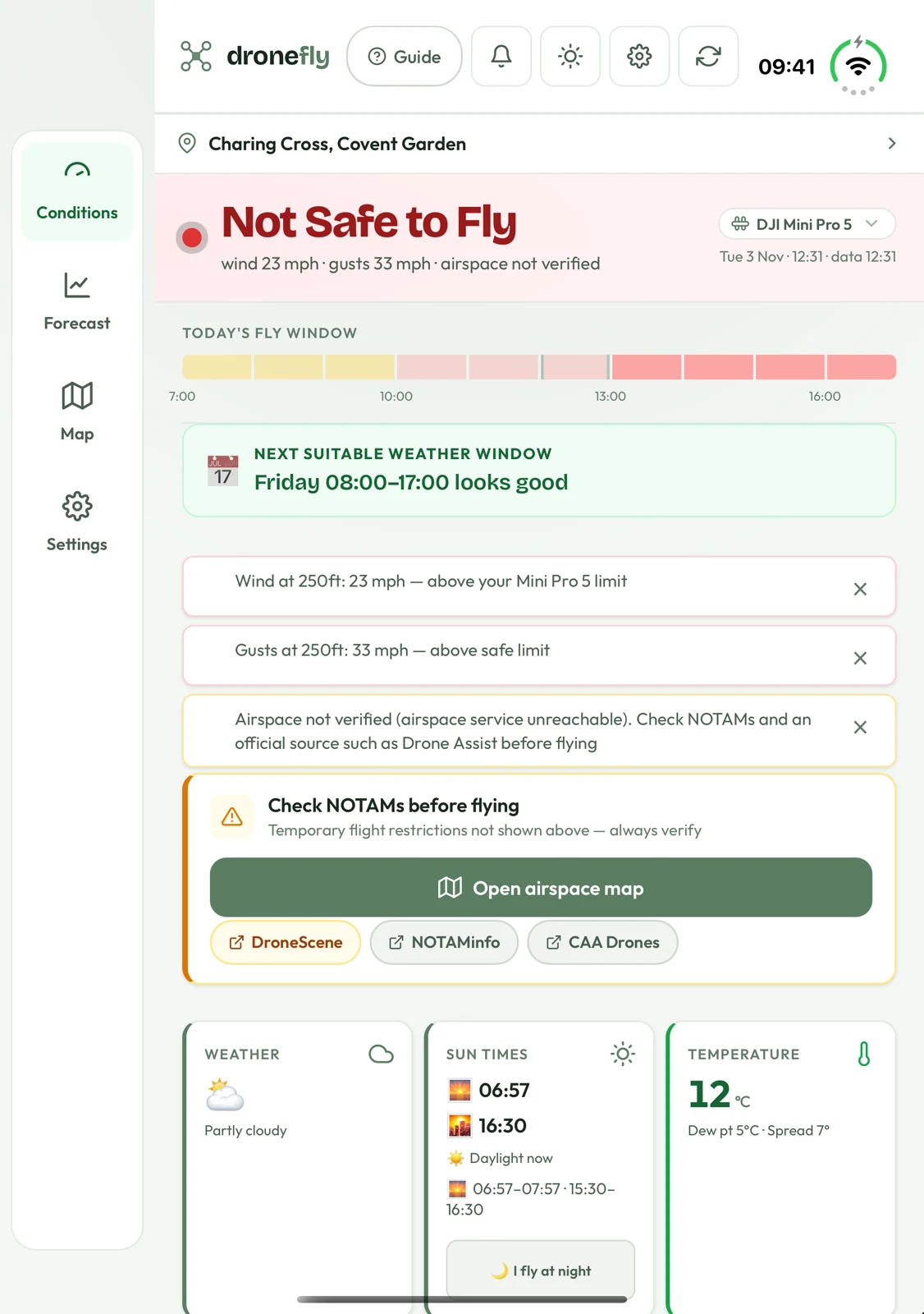
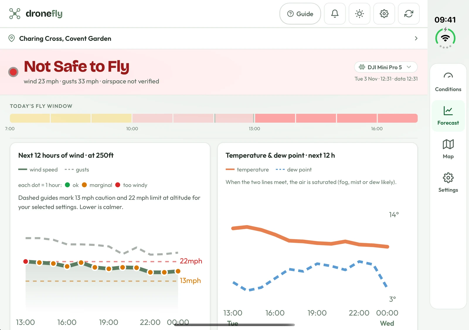
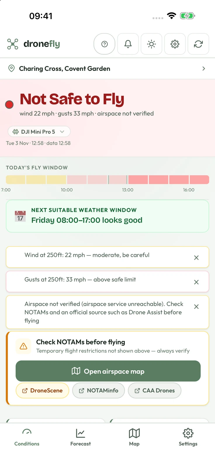
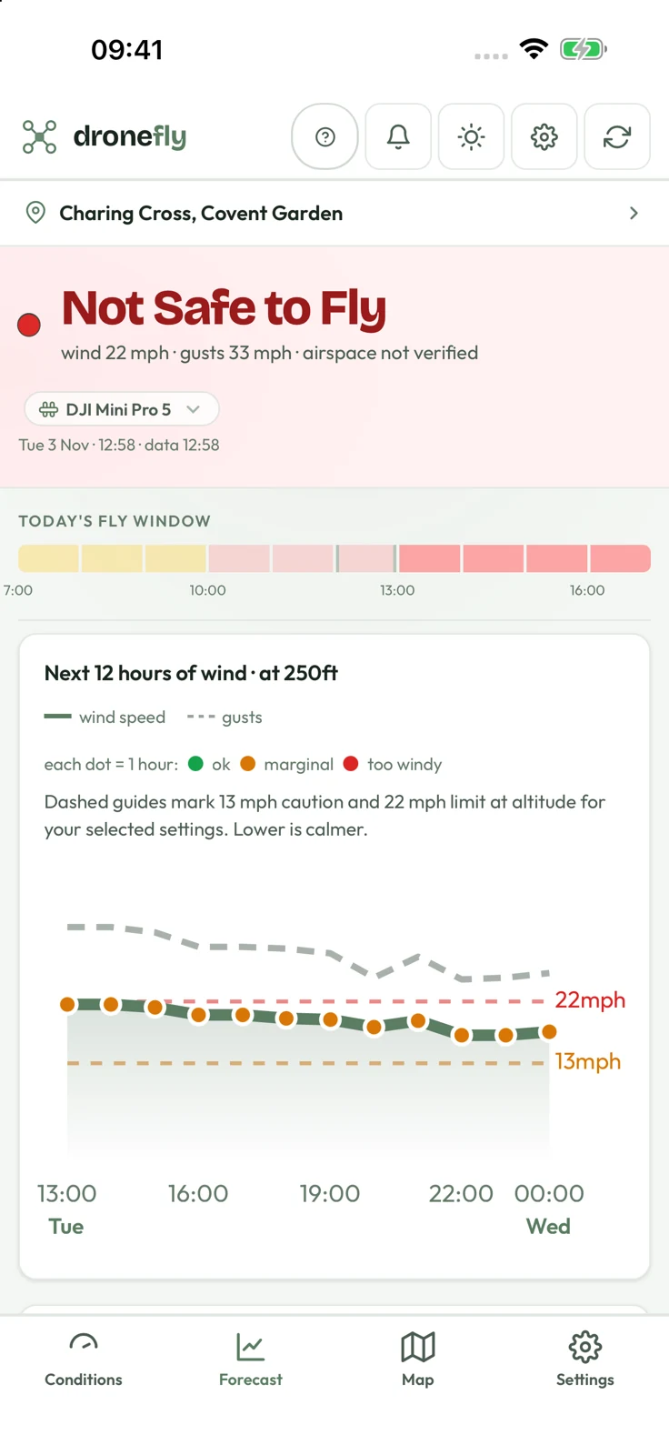
Conditions, forecast and map, side by side

The same verdict on iPhone, in the browser, and on Duo, where the navigation sits beside the content when the phone is open.

DroneFly conditions screen on an iPhone showing today's safe-to-fly verdict with wind, gusts, visibility and Kp tiles.
Today's verdictEvery condition scored for the drone you fly.
DroneFly forecast screen on an iPhone with hour-by-hour wind and fly-window charts.
Hour by hourFind the next suitable weather window.
DroneFly conditions on an open Duo in portrait, with the navigation rail on one screen and the verdict on the other.
Open on DuoNavigation beside the content, not over it.
DroneFly forecast charts side by side on an open Duo, with navigation below the clock.
Forecast, two screens wideCharts side by side when the Duo is open.

Screens shown are from a dated demonstration. Airspace is marked Unverified whenever the feed cannot be confirmed. Always check official restrictions and NOTAMs.

Fly responsibly

A planning aid, not a clearance

DroneFly helps you make a quick, informed call. It does not replace your own checks. Always confirm airspace and restrictions before you fly, and follow the UK CAA rules for your category.

Always verify airspace and temporary restrictions with DroneScene and the CAA Drone & Model Aircraft Code. You need a Flyer ID and Operator ID (free) from the CAA register to fly most drones in the UK.
Weather & air quality: Open-Meteo · Kp: NOAA SWPC · Airspace: OpenAIP · Traffic: adsb.lol · Geocoding: OpenStreetMap.